Village News
Cotswold Warden Walks & Bathscape Walking Festival – September 2023
Bathscape Festival 2023 Bathscape Walking Festival running from 9th to 24th September see https://www.bathscape.co.uk/walking-festival/
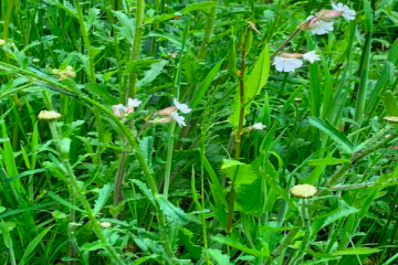
All proceeds to medical aid for Syria, Turkey & Ukraine Plants donated by West Kington Nurseries Now on at The Streams, West Kington Grid Reference: ST 80908 78703 Post Code: SN14 7JE Restock your garden and support Syria, Turkey and Ukraine. The sale is running throughout Summer with new stock arriving Read more…
Fosse Way – Gatcombe Mill – Fosse Way – Lugbury Longbarrow – Goulter’s Mill – Fosse Way Distance: 2.36 km Duration: 40-50 mins at average walking pace Elevation: ↑123m max.; ↓90m min. This walk can be split in half at the Fosse Way, with each walk taking around 25 minutes. Start at Read more…
West Kington Church – Wood Lane – Blacksmith’s Forge – Broadmead Brook – Nettleton Shrub Distance: 1.6 km approx. Duration: 35-40 mins at average walking pace Elevation: ↑135m max.; ↓101m min. In mid-May, ecologist Ann Skinner led some two dozen local nature-lovers on an expedition to discover a rich diversity of Read more…
Burton – Grittleton – Hullavington – Norton – Alderton – Acton Turville – Burton 17.3 miles, 530ft climbing (160m) Article by Ian Wilson Download map Leave Burton eastbound on the B4039 then turn left opposite the Coachstyle depot towards Littleton Drew. Pass under the M4 then take a Read more…
Blog by Ian Wilson A resume of local weather in the Burton area together with pointers of what to see in the night sky. The year started quietly with January dominated, much of the month, by a large area of high pressure or anticyclone (same thing). This gave us an unusually Read more…
Burton – Littleton Drew – Grittleton – Alderton – Badminton – Acton Turville – Burton 11.1 miles, 310 ft (95m) Download map Blog by Ian Wilson This route is best avoided after heavy rain as one section is liable to flooding. Leave Burton eastbound on the B4039 Read more…
Burton – Nettleton – West Kington – West Kington Wick – Mountain Bower – Fosse Way – Nettleton – Burton 8.4 miles , 500 ft (150m) climbing Download map Blog by Ian Wilson A shortish route but with a fair amount of climbing, though none too arduous with or Read more…
Burton – Littleton Drew – Alderton – Luckington – Sopworth (outskirts) – Little Badminton – Badminton – Acton Turville – Burton 13.3 miles, 630 ft climbing (190 m) Blog by Ian Wilson Download map This route features more total height gain than most, though none of the hills are Read more…